The biggest problem with trying to land on the actual continent is that there are not many places where you can just pull in your boat and hop out. Most of the coast of the continent projects uninviting obstructions to the seafarer. There is either the down slope end of a huge glacier that meets the sea in a vertical wall of ice a couple of hundred feet high. The ice breaks off (calves) at more or less a 90 degree angle to the water line. Or, the coast is a sheer mountain cliff that ends at the sea. If the mountain is not a sheer cliff, the sea sloping hill side ends up being covered with ice and snow and looking like the end of a glacier. Or, the coast is an ice shelf that has built up on the sea over the previous winter or winters. The ice shelf does the same calving as the valley glaciers. The ice shelf also breaks off in large chunks, too. About 15 years ago, a piece of ice shelf the size of Connecticut or Belgium broke off and floated out to sea.
Anyhow, there are a few spots where recent volcanoes have built up cinder and ash beaches down to the water’s edge. And, there are some other rocky beaches formed by more recent erosion or crumbling of the seacoast mountains. In both the volcano and erosion cases, snow and ice have not had thousands of years to build up and these black beaches warm up sufficiently in the spring and summer to clear the ice enough for a landing.
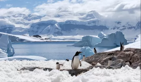
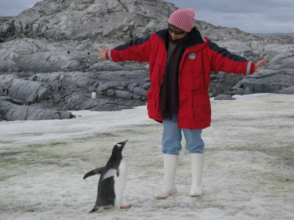
When it came time to land, our zodiacs pulled as close as possible onto the rocky shore, but the large boulders and chunks of ice made it necessary to jump out of the boat and into a foot or two of icy water. No one minded, however, because they just wanted to get on the land (and they had boots). Once on shore, we couldn’t really travel very far. From the small point of land where we hopped ashore, we were able to walk about a half mile along the rocky shore that curved into an inlet of ice filled sea. We couldn’t go far inland off the shore because we had a steep, penguin-littered, ice covered slope to our right and a wall of ice straight ahead.
Across the inlet from our beach, was a giant glacial wall. This wall of ice occupied the whole other side of the inlet and stretched from the side of the inlet opposite us to the most inland point of the inlet. The ice wall proceeded across the back end of the inlet all the way to our side. In other words, our stroll was blocked at the end of the inlet by a huge wall of ice. We were able to walk to within a hundred feet or so of the glacial wall and get a feel for its immensity.
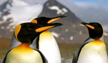
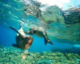
Of course, penguins were there too, and we had to be careful not to get in their way as they waddle to the water. Most had finished breeding and the chicks had lost their fuzz. We could see small pods of penguins darting in and out of the water and splashing around the boulders that sat on and in the water’s edge.
Across the inlet, we could also hear the ice groaning and cracking every now and then. Everyone was hoping to see a calving, and we were not disappointed.
I was surprised by the fact that the ice made a lot of noise before a big chunk would break off. So, we were able to direct our attention to the spot from where the cracking seemed to be coming. Twice we saw pretty good size pieces break off and splash into the water. Getting a photo of such an event is another story, however. We would hear the cracking, wait to see where the movement was and then try to pick up the falling ice in the camera’s lens and zoom in at the same time. (Wait until I show you the calving I caught on the camera a week later in El Calafate.)
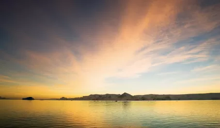
This setting on the shores of Antarctica made the trip worthwhile. Here we were on the shores of Antarctica, strolling around a stony beach watching penguins swimming and playing in an ice-choked bay, listening to the groan of the million year old ice of a glacier a stone’s throw away -- hoping that the calving ice didn’t create a tsunami too big for us to get away from. And, I forgot to mention, the sun was setting and we had an incredible sunset over the bay.
Antarctica
- Photos (23)
- Francis Andrews
- Antarctica, Expedition Cruises, Luxury & Indulgence, Photography, Traveler Stories, Whale Watching, Wildlife Watching
- The Journey Begins
- Rockin; and Rollin'
- Penguins on the Moonscape
- Zodiacing among the bergs
- On the Antarctic Beach
- Blue sky, warm winds and fantastic views
- Volcanoes and Calderas
- Whales Watching Tourists
- Doing the Drake Again
- More Rockin' and Rollin' on the Drake
- The End of the World
- The End of the Trip at the End of the World