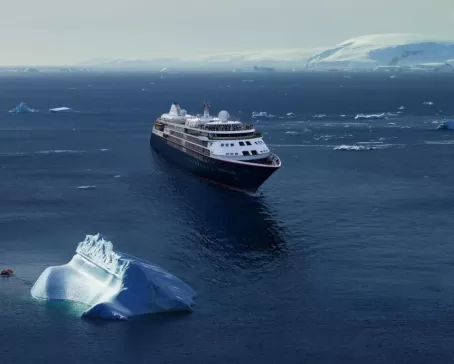
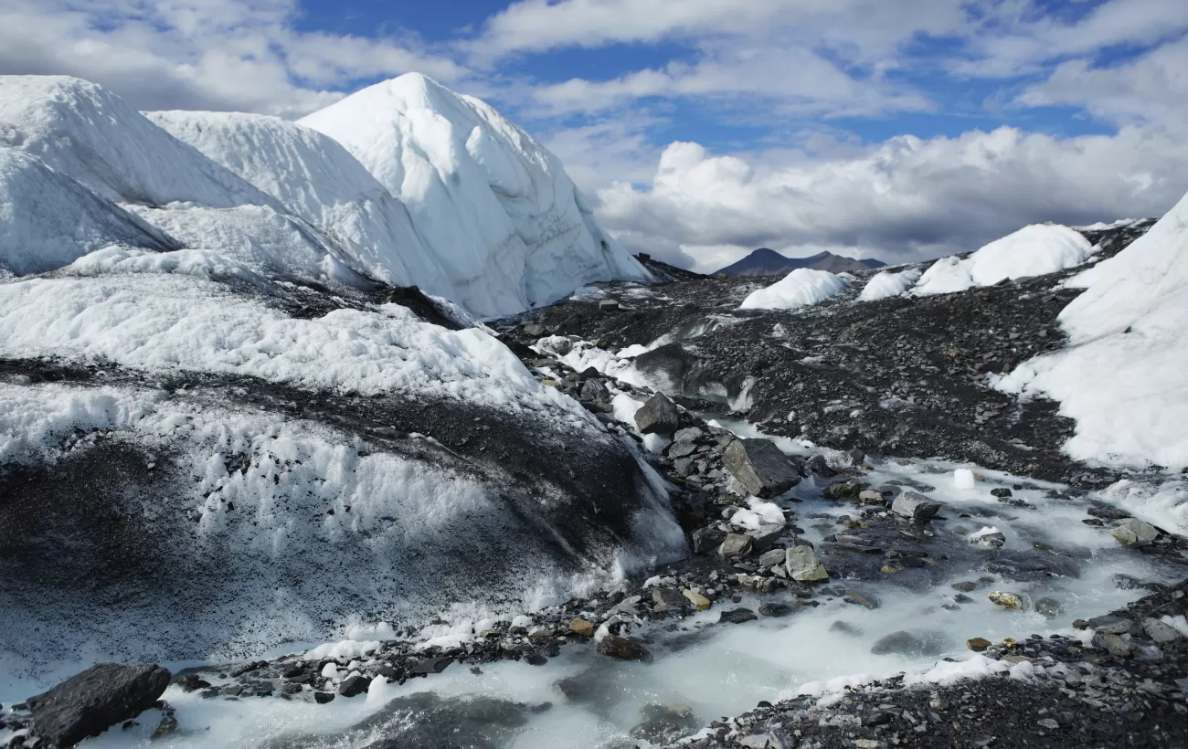
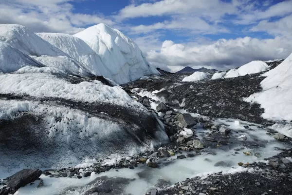
Follow in the footsteps of explorers seeking the Northwest Passage, beginning with Frobisher in the 1570s and ending with the world's most important modern-day explorer: you. Whether you're a first-time visitor or a seasoned veteran of the region, you can count on the raw beauty to captivate you endlessly. From crystal pure glaciers to an abundance of marine and wildlife, the Northwest Passage crossing aboard silver Wind is both enchanting and unforgettable.
Highlights
See the huge basalt mountain in Uummannaq.
Visit numerous archaeological sites and artifacts located in Pond Inlet.
Tour the memorial to Franklin and the three weathered wooden grave markers for his men.
Activity options vary depending on destination and operator. Activity level is determined by the range and intensity of activities you choose to participate in. Discuss with your Trip Planner which options are best for you.
Kangerlussuaq is a settlement in western Greenland in the Qeqqata municipality located at the head of the fjord of the same name (Danish: Søndre Strømfjord). It is Greenland's main air transport hub and the site of Greenland's largest commercial airport. The airport dates from American settlement during and after World War II, when the site was known as Bluie West-8 and Sondrestrom Air Base. The Kangerlussuaq area is also home to Greenland's most diverse terrestrial fauna, including muskoxen, caribou, and gyrfalcons.
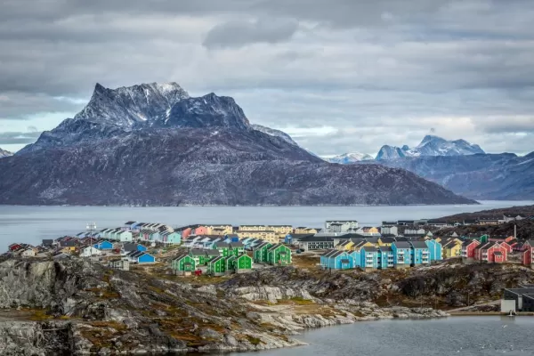
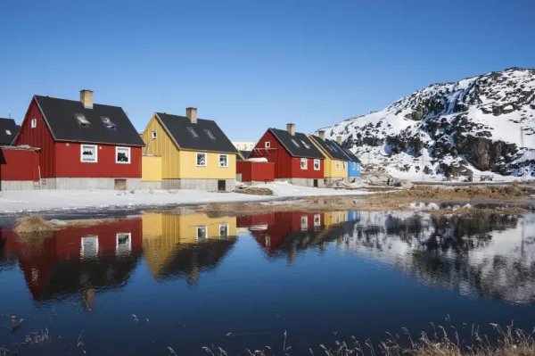
Kangaamiut (the People of the Fjords) is a settlement which clings to the shoreline of Greenland's Arctic Circle region, backed by some of the country's most spectacular fjordlands. The nearby pinnacle-shaped mountains gave the Danish-Norwegian colonial settlement its original name of Sukkertoppen (Sugarloaf) and the town recently celebrated its 250th anniversary. Here, one can experience small-town Greenlandic culture at its most authentic. The town is scattered across a small hill, displaying all the colourful buildings of the town at once; it is impossible to take a bad photo here. A system of staircases and boardwalks leads to the top of the hill, an area used to helicopter transport which offers jaw-dropping vistas of the wilderness around the settlement. The locals are proud of their Inuit history and culture, and the people of Kangaamiut are friendly and welcoming to vistors.
Evighedsfjord (Eternity Fjord) is a large fjord northeast of Kangaamiut in southwest Greenland. The fjord has a length of 75 kilometers and several branches with numerous glaciers coming down from the Maniitsoq Ice Cap to the north can be seen. The Evighedsfjord has several bends and whenever the ship reaches the supposed end the fjord continues in another direction and seems to go on forever. Qingua Kujatdleq Glacier is at its southeastern end. At the northwestern end a U-shaped valley has seven glaciers coming down from the mountains but not reaching the water. The glaciers had their maximum extent around the year 1870 and have gone through several cycles of advance and retreat. The mountains on either side of the fjord can reach in excess of 2,000 meters and the fjord has a depth of up to 700 meters. Evighedsfjord’s snowline is at 1,100 meters and the Evighedsfjord region is famous as one of Greenland’s best heli-skiing areas.
In the bustling capital city of Greenland, you could be forgiven for forgetting you are in such a vast and isolated country. Nuuk is Greenland's economic and social hub, home to more than a third of Greenland's population, and although it feels like a world capital, scratch the surface, and a uniquely Greenlandic character can be found underneath. Nuuk Cathedral overlooks the gorgeous old Colonial Harbour district and the Greenland National Museum, the resting place of the legendary Qilakitsoq mummies, the true highlight of the museum's archaeological collection. Above the Colonial Harbour sits downtown Nuuk, with lines of Scandistyle apartments, a bustling shopping district, the Greenlandic Parliament, Nuuk City Hall (which welcomes visitors to see its artwork) and even outdoor cafes selling locally produced food and beer.
Sisimiut ('The People of the Fox Holes') is Greenland's second city, the largest Arctic City in North America, and a hub between the warmer South and the frozen North of the country. With a young, dynamic population, including students from all over the country, Sisimiut is one of the fastest-growing cities in Greenland. Inhabited for more than four and a half thousand years, the Danish Colonial Era saw the rapid development of the city into a trade center, and the old buildings and artifacts can be seen at Sisimiut Museum, a collection of beautifully restored buildings displaying everything from ancient turf houses to modern Inuit art. The local artisans are considered some of the best in Greenland, and often sell their wares direct from their communal workshop in the harbor, where they barter with hunters for raw materials.
Known as the birthplace of icebergs, the Ilulissat Icefjord produces nearly 20 million tons of ice each day. In fact, the word Ilulissat means “icebergs” in the Kalaallisut language. The town of Ilulissat is known for its long periods of calm and settled weather, but the climate tends to be cold due to its proximity to the fjord. Approximately 4,500 people live in Ilulissat, the third-largest town in Greenland after Nuuk and Sisimiut. Some people here estimate that there are nearly as many sled dogs as human beings living in the town that also boasts a local history museum located in the former home of Greenlandic folk hero and famed polar explorer Knud Rasmussen.
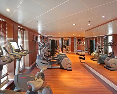
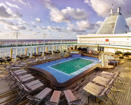
Days at sea are the perfect opportunity to relax, unwind and catch up with what you’ve been meaning to do. So whether that is going to the gym, visiting the spa, whale watching, catching up on your reading or simply topping up your tan, these blue sea days are the perfect balance to busy days spent exploring shore side.
Located in northern Baffin Island Pond Inlet is a small predo¬minantly Inuit community with a population of roughly 1 ,500 inhabitants. In 1818 the British explorer John Ross named a bay in the vicinity after the English astronomer John Pond. Today Pond Inlet is considered one of Canada's "jewels of the North" thanks to several picturesque glaciers and mountain ranges nearby. Many archaeological sites of ancient Dorset and Thule peoples can be found near Pond Inlet. The Inuit hunted caribou, ringed and harp seals, fish, polar bears, and walrus, as well as narwhals, geese, ptarmigans and Arctic hares long before European and American whalers, came here to harvest bowhead whales. Pond Inlet is also known as a major center of Inuit art especially printmaking and stone carving.
Austere, remote and rather severe, Devon Island is as close the closest thing to Mars on planet Earth. The rocky terrain, dry, cold climate and 14-mile wide crater on the north of the island have made it home for a team of research scientists from NASA, who live in the small research station during the Arctic summer. Other than these few men and women, Devon Island is completely unpeopled, and the largest uninhabited island in the world. There was human habitation as recently as 1951, when a Canadian Mounted Police post that had been on the island since 1924 to monitor illegal activities such as whaling closed. At 320 miles long and 80–100 miles wide, it is the largest of the Parry Islands. Dundas Harbour is found in the south of the island. Then the island is set in the icy Arctic Ocean, south of Ellesmere Island and west of Baffin Bay. This makes it Canada’s sixth largest island.
Day 10: Devon Island, Radstock Bay | Beechey Island
Devon Island is Canada’s sixth-largest island and was first seen by Europeans in the early 17th century. The Thule culture had already settled there many centuries before and left behind qarmat homes, made of rocks, whale bones, rock and sod walls, and skins for roofs that tell a story of over 800 years of human habitation. Other striking finds in this area are the many fossils of corals, crinoids and nautiloids that can be seen. Just across Lancaster Sound is Prince Leopold Island, a Canadian Important Bird Area, a federally listed migratory bird sanctuary, and a Key Migratory Bird Terrestrial Habitat site with large numbers of Thick-billed Murres, Northern Fulmars and Black-legged Kittiwakes that breed there.
Beechey Island is a small island off the southwest coast of Devon Island, separated by a narrow waterway called the Barrow Strait. Captain William Edward Parry was the first European to visit the island in 1819. His lieutenant, Frederick William Beechey, named the island after his father, the artist William Beechey (1753–1839). Beechey Island played a significant role in the history of Arctic Exploration. During the winter of 1845-46, Sir John Franklin and his men camped on the island as part of their ill-fated quest to find the Northwest Passage. Mummified remains of three of Franklin’s crew were discovered, giving a better understanding of what happened before the disappearance of the expedition. In 1850 Edward Belcher used the island as a base while surveying the area. Later, in 1903, Norwegian explorer Roald Amundsen stopped at the island at the beginning of his successful voyage in search of the Northwest Passage.
Resolute is one of the northernmost communities in Nunavut and Canada with slightly more than 240 inhabitants. The name goes back to HMS Resolute which was trapped and abandoned in the ice in 1850 while searching for traces of the lost Franklin Expedition. On the southern coast of Cornwallis Island it has long winters and as such is known as Qausuittuq (a place with no dawn) –with darkness from early November to early February. Although Pre-Dorset, Dorset and Thule remain indicate the area had been used for some 2,500 years, it was only in 1953 and the government enforced High Arctic relocation of Inuit that residents were not related to the weather station or the Royal Canadian Air Force base. Immediately north of Resolute’s strategically important airport is Tupirvik Territorial Park where fossils can be found on the beach, a former old seabed.
Peel Sound is a 30 mile wide, 125-mile long channel separating Prince of Wales Island to the west and Somerset Island to the east. It was named in 1851 by explorer Vice Admiral Horatio Austin in honor of Sir Robert Peel, a former prime minister of Great Britain. Austin, however, was not the first person to sail through the sound. Five years earlier, in 1846, Sir John Franklin had passed through the strait, just before his ships became icebound. Peel Sound is not always open. Several explorers, including Francis Leopold McClintock in 1858 and Allen Young in 1875, were unable to pass because it was blocked by ice.
King William Island’s flat coastal terrain holds only one settlement. Although the area around Gjoa Haven had already been used by the Netsilik Inuit, the Scandinavian name was given to it by Amundsen during his crossing of the Northwest Passage when he overwintered for two years with his ship Gjøa in the natural harbor on King William Island’s southeastern side. 250 kilometers above the Arctic Circle the average temperature hovers around 0 degrees Celsius in September. Amundsen’s presence (with a ship full of interesting supplies specifically brought for trade) attracted Netsilik from camps in the vicinity. The Netsilik had been here at Usqsuqtuuq -meaning “place of plenty blubber”- because of the fat fish and sea mammals in nearby waters. In 1927 the Hudson’s Bay Company set up a trading post and the community has grown from then on. Today some 1,500 predominantly Inuit inhabitants live in Gjoa Haven.
Southeast of Victoria Island and in Queen Maud Gulf, Jenny Lind Island is roughly 20 kilometers in diameter and covers an area of 420 square kilometers. The uninhabited island is named after a famous Scandinavian opera singer and was put on European maps in 1851 when Dr. John Rae of the Hudson’s Bay Company was searching the Canadian Arctic for indications of the fate of Sir John Franklin’s Northwest Passage Expedition. The island is a Canadian Important Bird Area with large numbers of Lesser Snow Geese and Ross’s Geese breeding there and a Key Migratory Bird Terrestrial Habitat recognized by the Canadian Wildlife Service. The island has a mix of flat and undulating terrain with low-lying wetlands and sedge meadows and supports a small herd of muskoxen. The island has been the site of a Distant Early Warning Line radar station until the 1990s and still is part of the North Warn System.
The area around Cambridge Bay was seasonally used by Pre-Dorset, Dorset, Thule, and Copper Inuit to hunt and fish. It was only after the Royal Canadian Mounted Police and the Hudson’s Bay Company decided to set up posts on Victoria Island in the 1920s that outsiders settled, while the Inuit community only came to live at Cambridge Bay in a more permanent way after World War II when a LORAN tower was built. Today Cambridge Bay is one of Canada’s northernmost villages with close to 1,800 residents. It is the administrative center for the Kitikmeot region and an important transportation hub for cargo by sea and air. Arctic char, which is caught in rivers nearby, is Cambridge Bay’s major export article. For many years Cambridge Bay was the home to Roald Amundsen’s ship Maud. Having served in the Arctic for several years, the ship was brought to Cambridge Bay by the Hudson’s Bay Company where she was beset by ice in 1926 and sank in 1930.
Found north of Kent Peninsula and south of Victoria Island, Nunavut’s roughly 160 kilometers long Dease Strait was named after Peter Warren Dease of the Hudson Bay Company. Sir John Franklin, who had been sent on an early attempt to map northern Canada and to search for the Northwest Passage, had received useful information from Dease at Fort Chipewyan before heading north during his first expedition. Traveling down the Coppermine River, Franklin then took 3 canoes entering Coronation Gulf heading northeast. Reaching Cape Flinders and continuing on to Point Turnagain in August 1821, he had effectively entered Dease Strait which continues on the east to Cambridge Bay, Victoria Strait and Queen Maud Gulf. Seals, white foxes and rabbits were hunted on Kent Peninsula and 73 bird species were recorded.
At the northwestern end of the Amundsen Gulf and the Northwest Passage, the Amundsen Trough is a submarine glacial trough leading into the Beaufort Sea. South of Banks Island and its Migratory Bird Sanctuary, northeast of the Anderson River Delta Bird Sanctuary, and north of Tuktut Nogait National Park, all within the Northwest Territories, the submarine feature and gulf are named after Roald Amundsen. Plough marks of iceberg keels with a width of up to 150 meters and a depth of up to 10 meters have been identified on the seafloor. Seismic research in 2014 has shown that at least nine Quaternary ice streams advanced through the Amundsen Trough, implying it was a major route for ice and sediment towards the Arctic Ocean.
Sachs Harbour is a small community of some 130 residents on the southwestern side of Banks Island, Canada’s fifth-largest island. It is the only settlement on Banks Island and the northernmost community in the Northwest Territories. The name goes back to the 30-ton schooner Mary Sachs, one of three ships in Stefansson’s Canadian Arctic Expedition 1913-1916. Sachs Harbour is surrounded by the Banks Island Migratory Bird Sanctuary No 1. To the west dry mud cliffs can be found, while the tidal mudflats, river deltas, wetland meadows and barren grounds with Dryas are used by some 95% of the Western Arctic’s Lesser Snow Geese, apart from Ross’s Geese, Black Brants, an estimated 25,000 King Eiders, several thousands of Long-tailed Ducks, Tundra Swans and Sandhill Cranes as key species. Banks Island is also home to more than half of the world's muskoxen, found mainly on the northern side, and Sachs Harbour has been called the “Muskox Capital of Canada”.
The Northwest Territories’ Smoking Hills show a natural phenomenon that has probably been active for thousands of years. The hills close to the Beaufort Sea were seen by John Franklin in 1826 during his second Canadian expedition looking for indications of a Northwest Passage. Franklin observed that the rocks and soil around Cape Bathurst seemed to be on fire and produced acrid white smoke. They were therefore named “Smoking Hills”. The reason behind this phenomenon is neither human-induced burning nor volcanic activity, but the subsurface exothermic reaction between the bituminous shale, the sulfur and the iron pyrite of the area. The heat is released through the oxidation of pyrites in the Cretaceous mudstones along the sea cliffs leads not only to high ground temperatures but also to hot sulfurous gas being driven off and the possibility of spontaneous combustion.
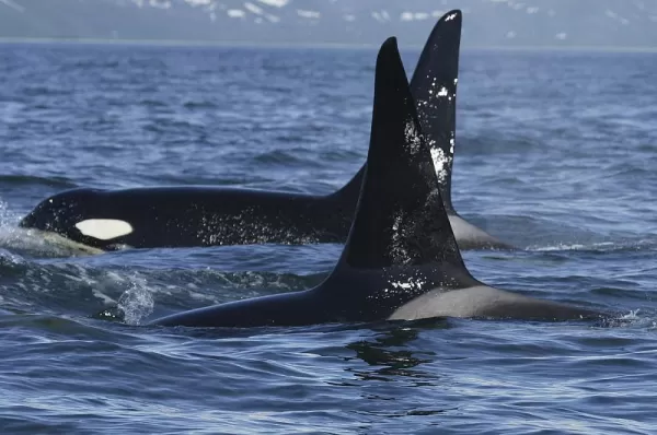
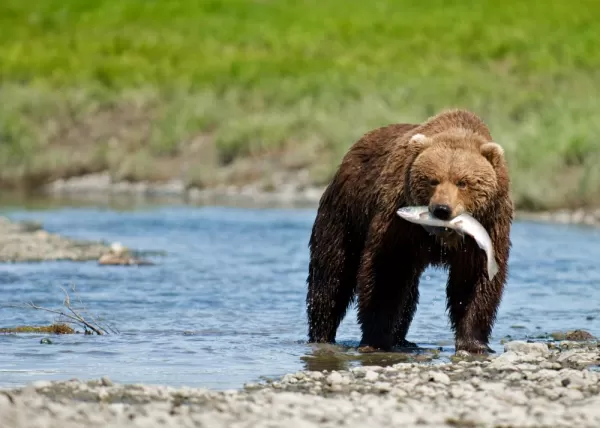
Take advantage of the brief summer thaw and enjoy the spectacular peculiarities of the Beaufort Sea. Frozen for most of the year, the Beaufort Sea is only navigationally possible during the short summer months of August and September when a channel near the Canadian and Alaskan shore opens up. Despite the sea being frozen for a sixth of the year, it is home to a myriad of wildlife, so lucky Northwest Passage travelers will be richly rewarded. Be on deck with binoculars and cameras at the ready for sightings of fish like Arctic char, birds like the king eider, marine mammals like beluga and bowhead whales, and, if you’re lucky, predators like the polar bear. However, circumstances in the rapidly changing Arctic might soon change the species habitations and have many scientists and ecologists are worried that the future of the wildlife of the Beaufort Sea hangs in the balance.
Three kilometers off Yukon’s north coast, only Workboat Passage separates Herschel Island-Qikiqtaruk from Ivvavik National Park. The low-lying treeless island of 116 square kilometers was Yukon’s first territorial park. Herschel Island-Qikiqtaruk has been declared a National Historic Site of Canada in 1972, classified as a Nature Preserve in 1987, designated a Natural Environment Park in 2002 and as an example of the technologies and techniques used for living and construction over the past several millennia, it is now on the tentative UNESCO WHS list! The island is also an important area for Ice Age fossils.
Days at sea are the perfect opportunity to relax, unwind and catch up with what you’ve been meaning to do. So whether that is going to the gym, visiting the spa, whale watching, catching up on your reading or simply topping up your tan, these blue sea days are the perfect balance to busy days spent exploring shore side.
Days at sea are the perfect opportunity to relax, unwind and catch up with what you’ve been meaning to do. So whether that is going to the gym, visiting the spa, whale watching, catching up on your reading or simply topping up your tan, these blue sea days are the perfect balance to busy days spent exploring shore side.
Day 26: Nome, Alaska | Disembark | Fly to and Arrive in Montreal
Nome is located on the edge of the Bering Sea, on the southwest side of the Seward Peninsula. Unlike other towns that are named for explorers, heroes or politicians, Nome was named as a result of a 50-year-old spelling error. In the 1850s an officer on a British ship off the coast of Alaska noted on a manuscript map that a nearby prominent point was not identified. He wrote "? Name" next to the point. When the map was recopied, another draftsman thought that the “?” was a C and that the “a” in "Name" was an o, and thus a map-maker in the British Admiralty christened "Cape Nome." The area has an amazing history dating back 10,000 years of Inupiaq Eskimo use for subsistence living. Modern history started in 1898 when "Three Lucky Swedes”, Jafet Lindberg, Erik Lindblom and John Brynteson, discovered gold in Anvil Creek…the rush was on! In 1899 the population of Nome swelled from a handful to 28,000.
After breakfast, board a charter flight back to Montreal. Transfer to the hotel and then catch your flight way back home.
Apologies for the inconvenience. Prices for not yet published. Below per person rate based on previous season. Contact us to confirm upcoming season pricing.
Prices for are estimated based on inflation. Contact us to confirm pricing and availability for your desired departure date.
$41,850
Rates are dynamic and fluctuate based on capacity. Contact us for a specific quote.
Select a Date
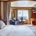
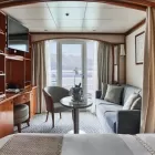
Vista Suite
Twin beds or queen-sized bed. Large picture window providing panoramic ocean views and comfortable sitting area. One bedroom: 240 sq ft / (22 sq m) One bedroom: Suite 738: 325 sq ft / (30 sq m).
Select a Date
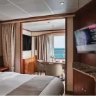
Classic Veranda Suite
Twin beds or queen-sized bed. Teak veranda with patio furniture and floor-to-ceiling glass doors and comfortable sitting area. One bedroom: 295 sq ft / (27 sq m) including veranda.
Select a Date
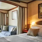
Deluxe Verdana Suite
Twin beds or queen-sized bed. Teak veranda with patio furniture and floor-to-ceiling glass doors and comfortable sitting area. One bedroom: 295 sq ft / (27 sq m) including veranda.
Select a Date
Medallion Suite
Twin beds or queen-sized bed. Teak veranda with patio furniture and floor-to-ceiling glass doors and a comfortable sitting area. One-bedroom Suite 741 has a single bedroom and measures 667 sq ft / 62 (sq m.) Two-bedroom Suites 801–804: 441 sq ft / 41 (sq m) including veranda.
Select a Date
Silver Suite
Twin beds or queen-sized bed. Teak veranda with patio furniture and floor-to-ceiling glass doors and a comfortable sitting area. One bedroom: 517 sq ft / (54 sq m) including veranda.
Select a Date
Royal Suite
Twin beds or queen-sized bed; Two-bedroom has additional twin beds or queen-sized bed. Large teak veranda and a separate dining area and bar. Royal Suite - 736 sq ft / (69 sq m) including veranda. Two-bedroom - 1,031 sq ft / (96 square meters) including veranda.
Select a Date
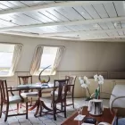
Grand Suite
Twin beds or queen-sized bed; Two-bedroom has additional twin beds or queen-sized bed. Large teak veranda and a separate dining area and bar. One bedroom: 1,019 sq ft / (95 sq m) including veranda. Two-bedroom - 1,314 sq ft / (122 sq m) plus veranda.
Select a Date
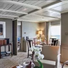
Owner's Suite
Twin beds or queen-sized bed; Two-bedroom has additional twin beds or queen-sized bed. Large teak veranda and a separate dining area and bar. One-bedroom: 587 sq ft / (55 sq m) including veranda. Two-bedroom - 827 sq ft / (77 sq m) plus veranda.
Our guide and driver were very good with their knowledge and were very helpful with our questions. It was a very pleasant visit that would have been impossible to do on our own. Hotels and restaurants were fantastic. The special places we got to go to, like the kitchens, were great. Enjoyed the entire trip!
Meyer Smolen
TrustScore 4.8 | 169 reviews
TrustScore 4.8 of 5
Based on 169 reviews on
32 minutes ago
Friendly and professional interactions. Answered my questions and followed up on initial contact.
Tim Elliott
1 day ago
Adventure Life has been an extraordinary travel resource for us over the years and today was no exception. Our River Cruise booking was handled by Jess (who has been our personal trip planner for several years) the same day as our inquiry. Suggestions were given for cabin choice and pre-trip options (that were not shown on the cruise line's website) like airport transfers and prepaid gratuities. Trip insurance recommendations followed and we were assigned a travel co-ordinator till the end of the tour. All we have to do is show up! Great service from friendly folks.
APtravelwell
2 days ago
My representative Kevin was very responsive generally and in crafting our itinerary to our specific priorities.
Rocco Labella
2 days ago
Although there was a lot of paper work, I received help and guidance when I needed it.
Donna Kirby
3 days ago
Our travel was flawless! The rider pickup (airport, hotel, ship) was seamless. Jane's recommendation for Emerald Cruise Sakara was everything I wanted but the experience was soooo much more. Adventure Life took care of each and every detail and this was the easiest of all my travels.
/454x364.webp)