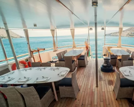
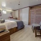
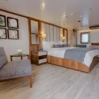
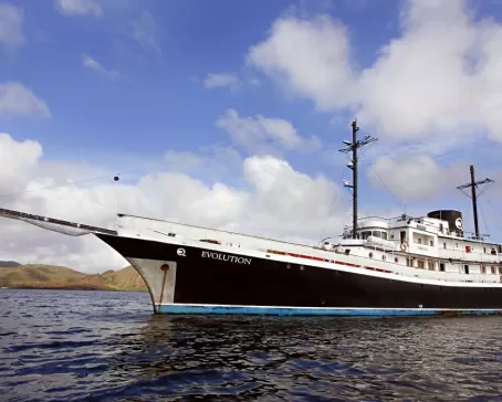
- Ship
- 1 Breakfast, 1 Lunch, 1 Dinner
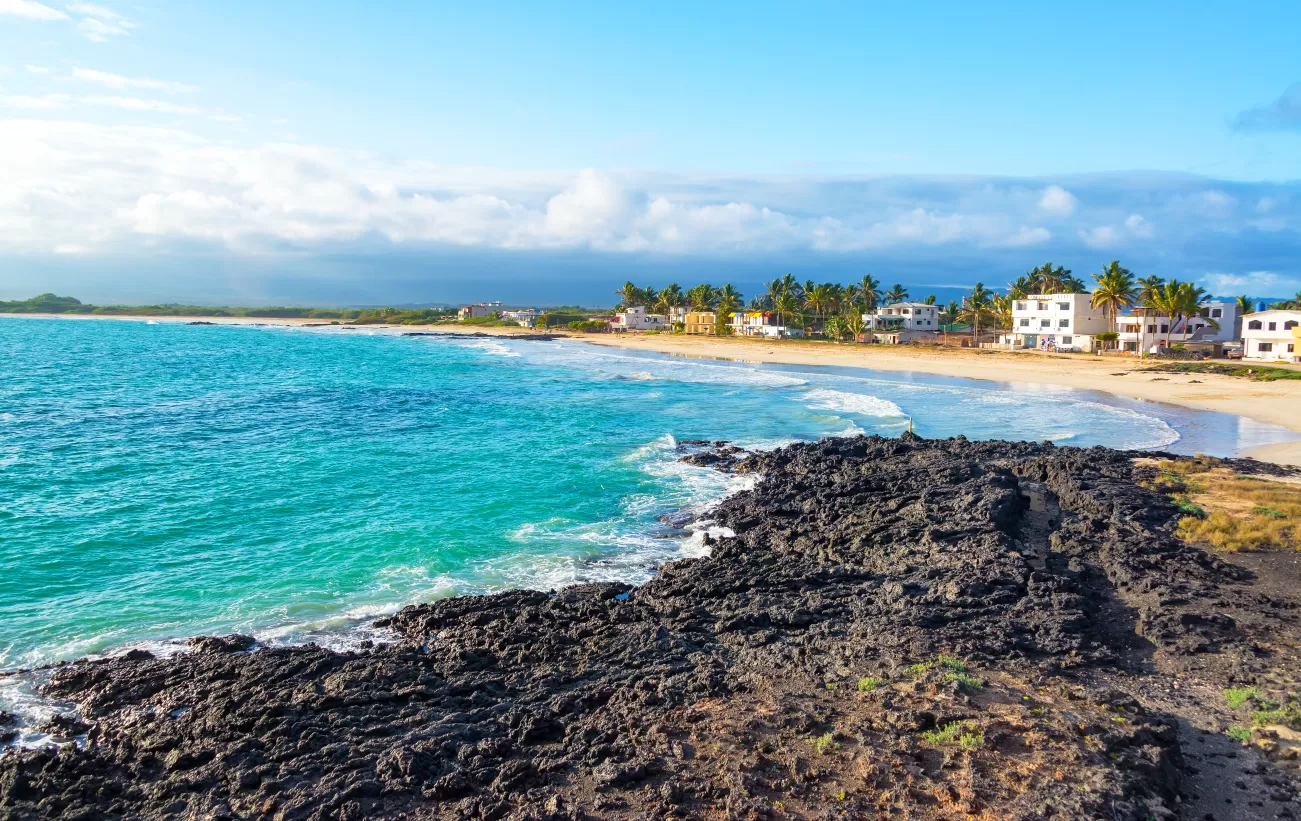
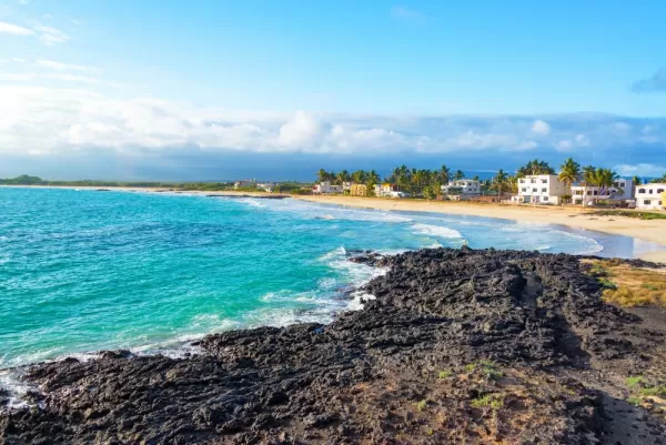
San Cristobal was the first island Darwin visited when he arrived in 1835. He reported encountering a pair of giant tortoises feeding on cactus during that outing. Today the airport of this easternmost island in the chain is increasingly used as the arrival point for flights into and out of the Galapagos. The administrative capital of the province is Puerto Baquerizo Moreno on the southwestern shore. Your guide will give you clear instructions on the rest of the day’s events before you go ashore. Once you arrive in the pot, board a dinghy (panga) to make the short crossing to the dock. In recent years a great deal of effort has gone into sprucing up the waterfront including the building of the new municipal dock. You only need to bring your day pack as the crew will pick up your luggage at your cabin and ensure that it gets to the airport, which is less than a 5-minute drive from the waterfront. One of the most sought-after sites in the Galapagos, Kicker Rock, also known as León Dormido, is the remains of a volcanic cone, eroded by the sea over hundredths of years. It is the eroded cone of an extinct volcano in the shape of a sleeping lion which earned it the name, Leon Dormido. Above the water, the monolithic rock formation towers over 500 feet above the Pacific Ocean and is home to various Blue-Footed Boobies, Frigatebirds, California Sea Lions, and Red-billed Tropicbirds.
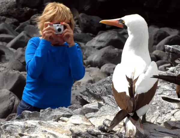
In 1998 the Galapagos National Park Visitor Center opened for the benefit of islanders and travelers alike, presenting a comprehensive exhibit of the islands’ natural history, human interaction, ecosystems, flora, and fauna. This is the place where cultural activities take place, including theatre, exhibitions, and workshops. From the Interpretation Center, a short trail arrives at Frigate Bird Hill, where both “magnificent frigates” and “great-frigates” can be seen in the same colony—ideal for learning to distinguish the two bird species.
The Visitor Center is also the place where cultural activities in San Cristobal Island take place, including theatre, exhibitions, and workshops. From the Interpretation Center, a short trail arrives at Frigate Bird Hill, where both “magnificent-frigates” and “great-frigates” can be seen in the same colony— ideal for learning to distinguish the two bird species. Along with your tour of the visitor center museum, there will be time to stroll the quaint tiny port town, with time to shop for souvenirs as you await the arrival of your new travel companions for a second week full of adventure in the Galapagos. Everyone will meet at the dock and board dinghies (pangas) to make the short crossing back to the Evolution.
Just as you did on arrival a week earlier, you’ll assemble once again on deck with the rest of the newly arrived Guests to review safety procedures and coming events with your Galapagos National Park Guide. While this is taking place the Evolution will start her engines and set out to the next landing site. Heading up the coast from Wreck Bay and Puerto Baquerizo spot Leon Dormido to the north. Also known as Kicker Rock, the spectacular formation rises 152 meters (500 feet) out of the Pacific. It takes the form of a sleeping lion (hence its Spanish name), but from another angle you can see that the rock is split, forming a colossal tablet and, piercing the sea, a great chisel ready for etching.
Type of Landing: Dry
Level of Walk: Easy
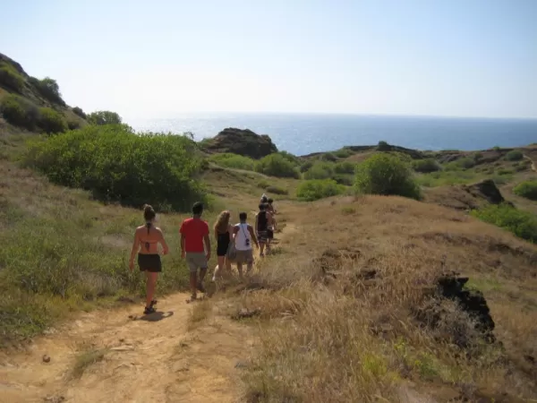
Other Activities: Nature Hikes
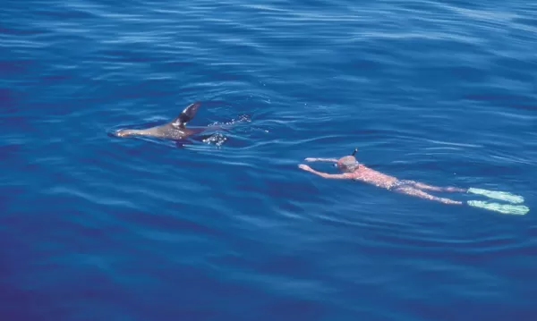
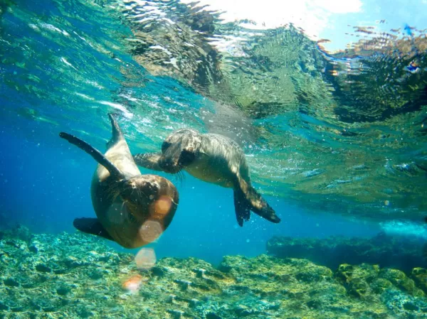
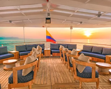
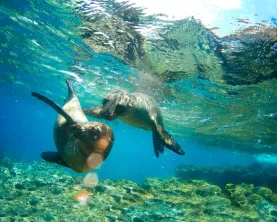
Set out along the coast of San Cristobal heading northeast toward landing at Cerro Brujo. This inviting powdery beach beside turquoise waters is a great introduction to the islands offering your first opportunity to go snorkeling with sea turtles, rays, and the archipelago’s playful ‘wolves of the sea’ i.e. sea lions. After walking the trail in search of baby sea lions and boobies beneath the salt bushes have a real treat in store. Change into snorkeling gear for some swimming with sea lions! The sea lions like to dart past, and then swim up to you to blow bubbles at your mask. On occasion, they have been known to leap over, and then dive in front of unsuspecting snorkelers. In short, the sea lions are real show-offs and this is the first place where you will have the opportunity to go snorkeling with them. Following our outing you will discover that the best place to warm up from your dip is in the Evolution’s oversized Jacuzzi. The afternoon comes to a close as head south back to Puerto Baquerizo Moreno. Enjoy your Pacific sunset aboard the Evolution by celebrating happy hour atop her sky lounge where drinks are available daily along with hors d’oeuvres. A little later gather in the main salon for the daily presentation by guide on the next day's activities and visitor sites, before sitting down to dinner. Spend a bit more time in port this evening before setting sail for your next destination to the northwest.
Type of Landing: Wet
Other Activities: Snorkeling, Panga Ride, Kayaking & Nature Hikes