Windward Islands Overview
The Windward Islands form the southern chain of the
Lesser Antilles in the eastern Caribbean Sea. Their name comes from their location relative to trade winds and sailing routes. Historically, ships traveling across the Atlantic first encountered these islands on their way into the
Caribbean, making them windward compared to the Leeward Islands farther north.
A Windward Islands map today shows a beautiful arc of islands stretching from Dominica in the north down to Grenada in the south.
Geography and Location
The Windward Islands lie between the Caribbean Sea and the Atlantic Ocean, making them a natural gateway to the southern Caribbean. This group includes Dominica, Martinique, St. Lucia, St. Vincent des Grenadines, and Grenada. Some definitions also place Barbados and Trinidad and Tobago within the Windward group because of their geographic proximity and early colonial history.
Located in the tropics, these islands enjoy a warm climate year-round. Cooling trade winds bring steady breezes, while the surrounding seas help regulate temperatures. Rainfall is frequent, especially on the windward sides of the mountains, creating lush forests and fertile valleys. Each island’s geography is distinct, but together they form one of the most scenic regions in the Caribbean.
For travelers researching the
Windward Islands islands, it helps to know that each one offers a unique mix of landscapes and experiences.
Volcanic Origins
The Windward Islands were created by volcanic activity along the boundary of the Caribbean and Atlantic tectonic plates. Subduction of the Atlantic Plate under the Caribbean Plate pushed molten rock to the surface, building the islands over millions of years. This volcanic origin explains the dramatic peaks, rugged coastlines, and fertile soils that characterize the region.
Several islands are home to active or dormant volcanoes. Martinique’s Mount Pelée is one of the most famous, known for its 1902 eruption. Saint Lucia’s Pitons, two striking volcanic spires, are a UNESCO World Heritage Site and a symbol of the island. Saint Vincent’s La Soufrière volcano has erupted multiple times in modern history, most recently in 2021.
These volcanic features not only shape the islands’ appearance but also influence their ecosystems and agriculture.
Physical Landscape
The terrain of the Windward Islands is dominated by mountains, steep valleys, and dense tropical forests. Dominica, often called the Nature Island, has some of the highest peaks in the Eastern Caribbean, along with waterfalls, boiling lakes, and hot springs.
The islands’ high rainfall supports rich biodiversity, with rainforests, mangroves, and coastal ecosystems teeming with plant and animal life.
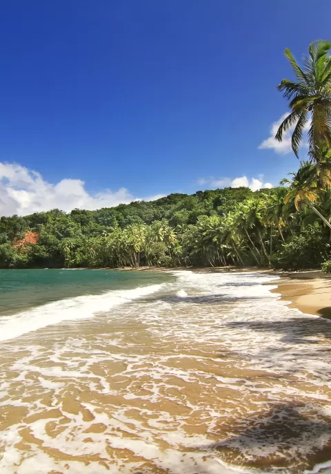
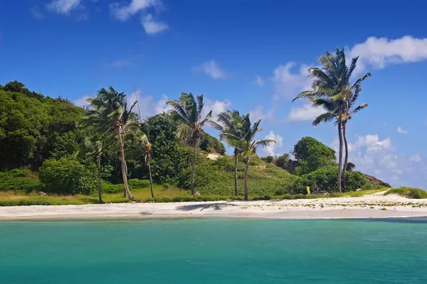
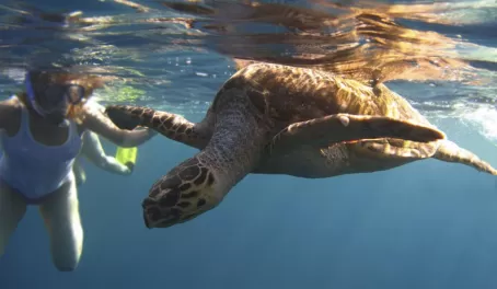
On the coasts, visitors find a mix of white-sand beaches, black volcanic shores, and rocky cliffs. Coral reefs and clear waters surround many of the islands, offering habitats for marine life and opportunities for snorkeling and diving. Inland, fertile volcanic soils support farming of bananas, cocoa, nutmeg, and other crops that sustain local economies.
Highlights of the Islands
- Dominica: Known for its rugged peaks, rivers, and protected rainforests.
- Martinique: French-Caribbean culture and the looming presence of Mount Pelée.
- St. Lucia: Home to the iconic Pitons and a dramatic volcanic landscape.
- St. Vincent des Grenadines: A chain of islands and cays offering beaches, reefs, and active volcanic scenery.
- Grenada: Also known as the “Spice Isle” for its nutmeg and cocoa plantations, with rolling hills and coastal beauty.
Each of the Windward Islands has its own cultural traditions, but all share the natural beauty shaped by their volcanic origins and tropical setting.
Ready to discover the beauty of the Windward Islands?
Get in touch with one of our trip planners today to start planning your perfect Caribbean getaway.