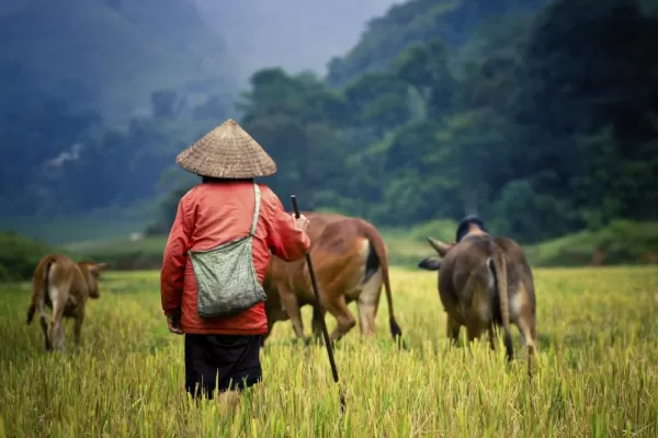
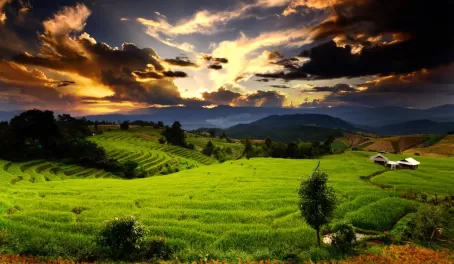
Sa Pa (or Sapa) town is located in the Lao Cai province, approximately an hour drive from the town of Lao Cai in northwestern Vietnam. Considered to be the tourism center for the northwest region, the epic scenery in the mist covered hills and local hill tribe villages spread throughout the area make this a premier destination for trekkers looking to get an up close and personal cultural experience while on a Vietnam trip. Several ethnic minority groups make the Hoang Lien mountains their home, with five main ethnic groups making up 85% of the population: Hmong, Dao (Yao), Tay, Giay (Zay), and the Xa Pho. A majority of the people in these hills wok the land on sloping terraces made for growing rice or corn, while others find their sustenance from selling handicrafts in the markets in Sapa town.
This region was originally colonized by a variety of ethnic groups. The Kinh (lowland Vietnamese) never originally colonized this territory and only recently resettled in this area in small numbers in the late 20th century. The French took note of the region in the 1800s under they took military in 1891. As hostilities broke out following WWII, nearly all the French colonial buildings in Sapa were destroyed in the early 1950s. In the 1960s, new inhabitants from the lowland regions began to re-inhabit the town, along with hill tribes in the region. Now Sapa town and the surrounding regions are experiencing a full economic boom due to the large and sudden influx of tourists.
The region is covered by the Hoang Lien Mountains, whose varying altitudes lend itself to a diversity of flora and fauna given the altitude. The higher one hikes, the less diversity is found. At around 2500m (8200 ft), the forest distinctly becomes what is termed an “elfin forest”. Lack of topsoil and other nutrients make it so that the trees only grow a few meters in height and only hardy plants such as conifers and rhododendrons can thrive. At around 3000 m (9850 ft), the terrain supports only dwarf bamboo. FansiPan is the highest summit in the mountain range sitting at 3143m. Most of the protected area of Hoang Lien Nature Reserve sits at 1000m (3280 ft) or higher and the majority of the mountain slopes are steep making the terrain inaccessible even to hikers on foot. The climate is highly seasonal, with annual temperatures in the 60F range, with a fluctuation in temperatures from as low as 34 to 85F throughout the year. The warmest months (and also the wettest) are July and August, which fall during the wet season which takes place from May to September. The coldest months are December and January.
Sources:
https://en.wikipedia.org/wiki/Sa_Pa
http://www.lonelyplanet.com/vietnam/northwest-vietnam/sapa
http://grrrltraveler.com/countries/asia/vietnam/things-to-know-about-sapa/
http://www.sapa-vietnam.com/