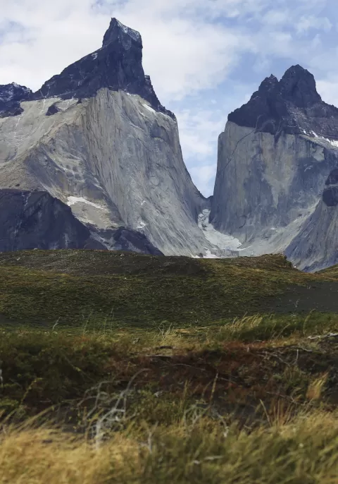
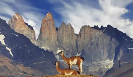
Torres del Paine's landscape is dominated by the huge Paine Massif, also known as the Cordillera del Paine. Although technically part of the Andes mountain range, the Paine Massif is an independent mountain formation with unique characteristics. 12 million years of the sedimentary layers of the earth being lifted up and slowly worn down by glacial erosion has resulted in this massif. Now only hard granite rock is left. Classic examples of the result of this process are the iconic, jagged Torres. Also, the stark difference in color between the sedimentary and granite rock can be seen in peaks throughout the national park.
The landscape of Torres del Paine is comprised of beautiful valleys, majestic glaciers, pristine lakes, towering mountains, chilly rivers, and rushing waterfalls. Here is a guide to some of the specific geography visitors will experience while in the park.
Valleys
- Valle del Francés (French Valley)
- Valle Bader
- Valle Ascencio
- Valle del Silencio (Silence Valley)
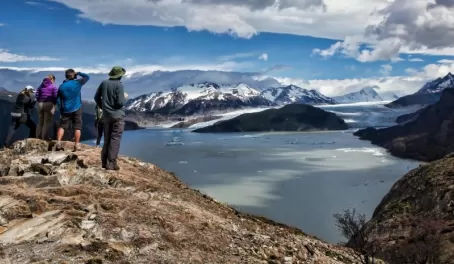
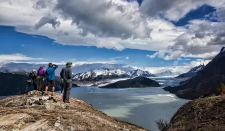
Glaciers
- Southern Patagonian Ice Field - The second largest ice field in the world and part of the Patagonian ice sheet which remains from the last glacial period
- Grey glacier - In the Southern Patagonian Ice Field
- Dickson glacier - Southeastern outflow from Southern Patagonian Ice Field
- Tyndall (Geike) - In the Southern Patagonian Ice Field
Lakes
- Grey - Glacially-fed lake
- Nordenskjöld - Pouring into Lake Pehoe through waterfall Salto Grande
- Pehoe - Fed by Paine River, running through waterfall Salto Grande
- Dickson - Fed by Dickson glacier and drained by Paine River
- Sarmiento
- Del Toro - only a fraction of the lake is in the national park
Mountains
- Cerro Paine Grande (Big Paine Mountain) - 10,000ft - highest mountain in the massif
- Cerro Paine Chico/Almirante Nieto (Small Paine Mountain) - 8,694ft
- Torres del Paine (the Towers) - South Tower 8,200ft, Central Tower 8070ft, and North Tower 7415ft
- Cerro Fortaleza (Fort Hill) - 9,842ft
- Cerro Catedral (Cathedral Hill) - 7,283ft
- Cerro Negro and Los Mezillos (Black Hill and the Twins) - 8,038ft
- Cerro Escudo (Shield Hill) - 8,858ft
- Cuernos del Paine (Paine Horns) - Central 8,530ft, North 7,874ft, and East 7,874ft
Rivers
- Paine - Sourced by Dickson lake, runs through Paine lake, Nordenskjöld lake, Pehoé lake and empties into Del Toro lake
- Grey - Outflow of Grey Lake, running 12.5 miles before merging with Serrano river
- Serrano - Grey river is main tributary, flows into the Last Hope Sound inlet
- Pingo - Runs into Serrano river
Waterfalls
- Paine Waterfall - Located on Paine river between Blue lagoon and Amarga lagoon
- Salto Grande (Great Falls) - Falls from northeastern tip of Nordenskjöld lake into Pehoe lake at a height of 213 feet
- Salto Chico (Small Falls) - Falls between the southern tip of Pehoe lake into Toro lake